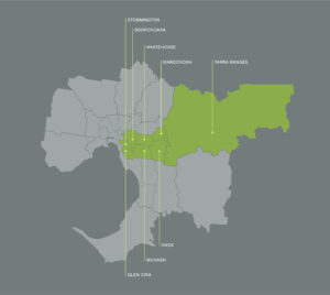
The Eastern Alliance for Greenhouse Action (EAGA) represents eight councils in Melbourne’s east, covering a large area of Traditional Land. Wurundjeri Woi-wurrung and Bunurong are names for the Indigenous language groups of First Nations peoples whose lands cover the northern, eastern and south-eastern regions of Victoria. The approximate boundaries of these two language groups extend to the Wombat State Forest in the west, the Great Dividing Range to the north, the Upper Yarra mountains to the east, and a complex southern boundary, which was recently redrawn.
EAGA acknowledges the Wurundjeri Woi-wurrung and Bunurong peoples of the Kulin Nation as the Traditional Owners and Custodians of the land on which EAGA councils occupy.
We pay our respects to their Elders past and present. We acknowledge and uphold their continuing relationship to this land and recognise that sovereignty was never ceded.
EAGA’s region covers approximately 3,000km2, extending from densely populated urban areas in the west to less populated rural areas in the east. The region includes a range of features:
- 18% of Victoria’s population (1,011,641 total)
- 34% of households considered low income
- 25% of residents are renters and 26% are born overseas
- 62% of businesses in the region are home-based
- 43% of industries (by employment) are in healthcare, professional services, retail and manufacturing sectors
- The industrial areas in Knox, Maroondah and Monash are a core strength of the region’s economy and major contributor to Victoria’s manufacturing sector